In simple terms, charting the ocean means looking at shallow and deep depths, marine life, and differing pressure. Before we had the technology that we do today, charting the ocean used to be terrifying. This was thanks to a lack of knowledge and specialized equipment. It was a perilous endeavor that left the ocean as a mystery more often than not. Hydrographers also had no idea what was lurking beneath the ocean’s surface. As scientists learned to chart the ocean more and more, they made incredible discoveries, though there’s still much of the ocean that remains unknown. In modern times, they use robots to navigate parts of the ocean that are too dangerous for humans to enter.
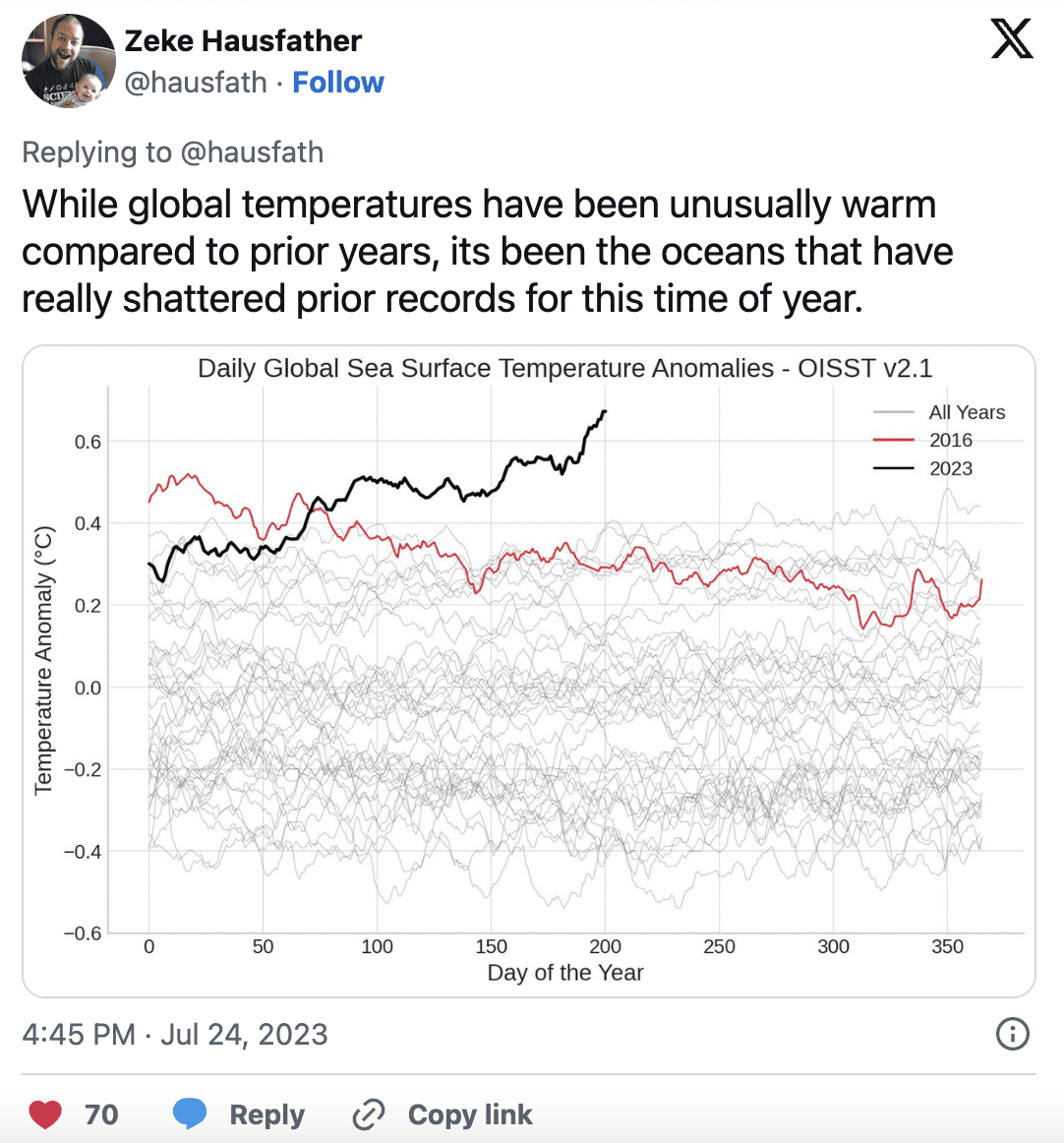
Nowadays, scientists also chart the temperature of the ocean. While air temperature fluctuates every year, it’s typically matched by an increase or decrease of heat stored in the ocean. Even though jumping into the ocean and realizing in warm waters might feel like a good thing, it’s bad. In 2014, the ocean’s temperatures were record-breaking. And because of this giant spike in temperature, the NOAA had to rescale its heat chart. It’s terrifying news. Each of us plays our part, and through climate change awareness, we can try to use less plastic, carpool more often, and lessen our carbon footprint.

Fear of Falling Off the Edge of the World
The fear of falling off the edge of the Earth was so deeply ingrained in the minds of early sailors that it often restricted their willingness to explore. This fear not only limited the extent of maritime expeditions but also hindered scientific progress and geographic knowledge, as many were reluctant to challenge the prevailing belief in a flat Earth. It wasn’t until the Age of Exploration and the accumulation of substantial evidence to the contrary that the concept of a spherical Earth became widely accepted, eventually enabling more ambitious and fearless voyages across the world’s oceans.
Sea Monsters
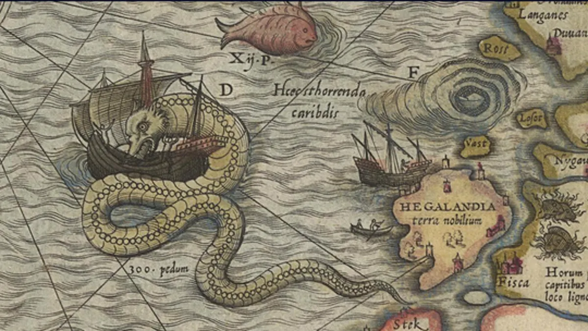
The legends of mythical sea monsters such as the Kraken, Leviathan, and colossal serpents not only stirred deep-seated fears among mariners but also added an aura of mystery and dread to their oceanic journeys. These creatures were often described as gigantic, tentacled beasts capable of capsizing ships or dragging them into the abyss. The fear of encountering these monsters haunted sailors, and their stories were shared through generations, further amplifying the trepidation associated with venturing into uncharted waters. The psychological impact of these tales cannot be underestimated. Sailors would scan the horizon with anxiety, imagining the lurking horrors beneath the waves.
Unpredictable Weather
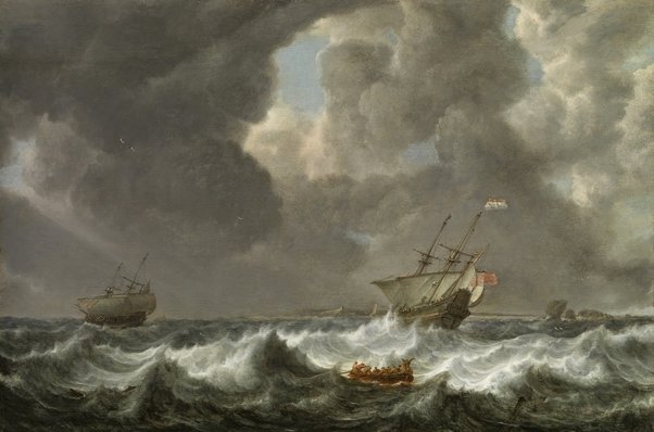
The unpredictable and treacherous weather at sea added a constant element of fear and danger to maritime exploration throughout history. Ancient mariners, devoid of the advanced weather forecasting tools we have today, were at the mercy of the elements. Sudden storms, hurricanes, and rapidly changing weather patterns could spell disaster for their voyages, turning calm seas into deadly tempests within moments. Navigators of the past had little ability to predict these weather events accurately, and as a result, expeditions were often fraught with peril. Shipwrecks, loss of life, and the destruction of valuable cargo were common consequences of encountering severe weather conditions.
They Had Limited Navigation Tools
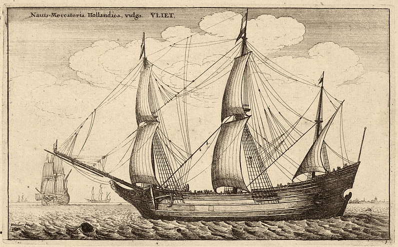
Before we had the technology we have today, we had to work with what we had or didn’t have. All scientists had been compasses, lead lines, sand glasses, cross-staffs, and Astro-labs to help determine location. The lead line was a hollow weight made of lead, which sunk to the bottom using animal fat. The maps of a compass and physical maps were hard to follow because of the numerous lines and limited knowledge. This happened before the introduction of Electronic Chart Display and Information Systems (ECDIS). With an unlimited understanding of latitude and longitude and a limited way of accurately telling time, it made it easy for ships to get lost out at sea (Martek Marine).

Psychological Effects Due to Isolation on Voyages
The isolation and psychological effects of long ocean voyages were an often-overlooked but significant source of fear and unease for sailors throughout history. Being surrounded by vast expanses of open water for extended periods took a toll on the human psyche. The absence of visible land led to a sense of profound isolation, with no respite from the seemingly endless horizon. Boredom and monotony were constant companions during these journeys, exacerbating the psychological strain. The fear of the unknown, coupled with the eerie quietude of the open sea, created an atmosphere of dread and uncertainty. Sailors had to contend not only with the physical challenges of their expeditions but also with the mental strain of being far from familiar surroundings and the safety of land.
The Sea Is, And Was, Always Changing
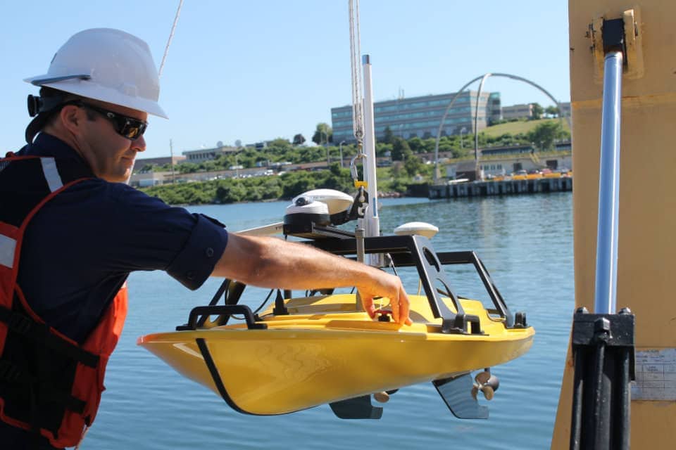
The sea is constantly changing thanks to tide changes, harbor depths, and the shapes of coastlines. Back then, with limited tools to accurately measure this change, scientists had to predict and make rudimentary, inaccurate calculations. Nowadays, professional hydrographers use this information to chart the ocean, but with more accuracy. Imagine trying to measure the tide changes using a sand glass or measurement of the moon’s location. With growing technology, other things that change are communications cables, bridges, pipelines, and marinas (Ocean Service).
No Accurate Maps Existed
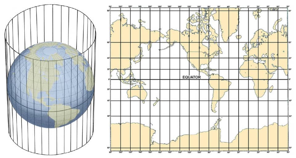
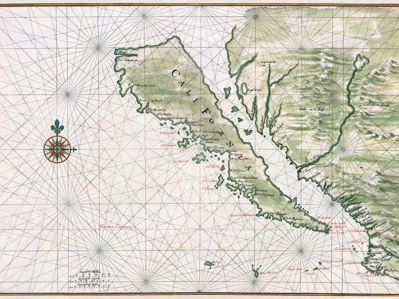
If you thought using Google Maps on your phone was hard enough, try navigating an entire ocean using an old map. Not only did those maps have tons of lines criss-crossing every which way, but a lot of the information was inaccurate. Some explorers assumed pieces of land, like California, were islands. Others mistook a large desert in the middle of Australia for the sea. Neither of those sound like mistakes you’d want to find yourself in (Future Maps).
The Ocean Has Black Holes
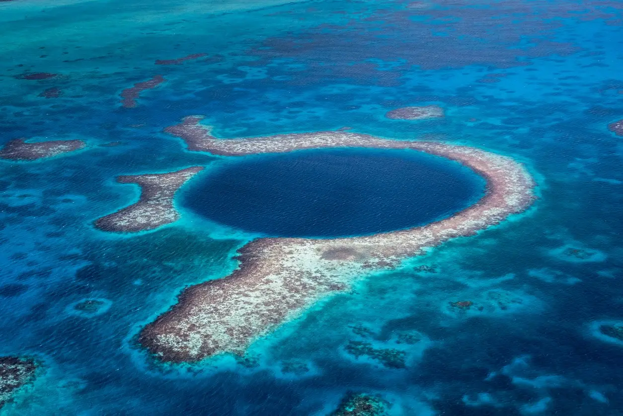
One reason charting the ocean used to be so terrifying is thanks to the ocean’s black holes, or eddies, which remained a mystery for quite some time. These are very similar to the black holes seen in outer space. These are strong vortexes of water that can destroy anything and everything in its way. Some of these black holes stretch 93 miles or 150 kilometers. One of the negative impacts of this, though, is that it transports warm water. This can affect the rising of sea levels, which may cause a severe rise in sea levels and warming temperatures (Green Matters).
There Are Always New Creatures
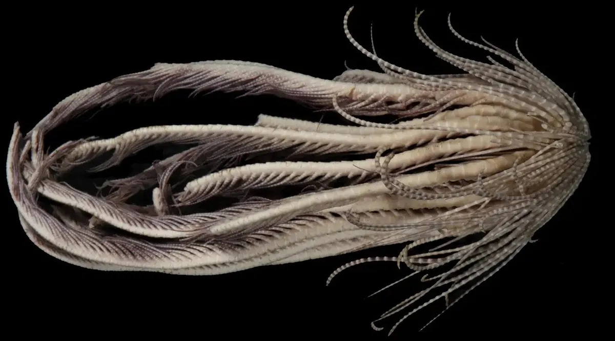
Even in modern times, scientists are constantly discovering new creatures. Back then, every single creature was new. No one could predict how they’d act or move. There are deep sea creatures that are terrifying to look at. The frilled shark, fangtooth, and goblin shark are monsters of the ocean that scientists are learning about. These are worse than anything you can find in the jungle or rainforests. These bizarre alien-like creatures lurk in the depths of the Atlantic Ocean (Hydro International).
There Wasn’t An Antidote For Deadly Jellyfish
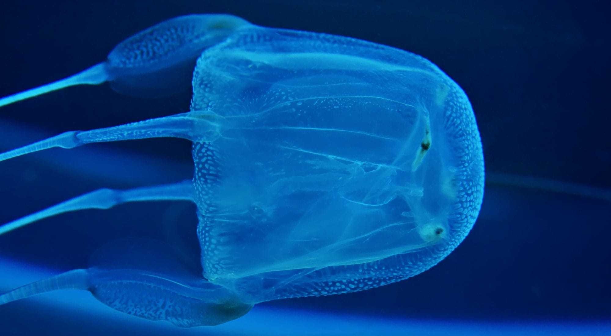
It’s not the sharks you need to be afraid of, but jellyfish, and this was true back then, too. Because there are millions of jellyfish in the ocean, they’re a much greater threat than sharks. Jellyfish have a higher body count than sharks. Shark attacks are rare, but jellyfish stings are not. This is thanks to their venom and our limited ability to detect them. Hundreds of years ago, if you were stung by a Box Jellyfish, there was no cure or proper way to take care of you. Box jellyfish are some of the most poisonous creatures in the world, and one sting can attack your nervous system and cause detrimental damage (National Geographic).
It’s Full Of Garbage
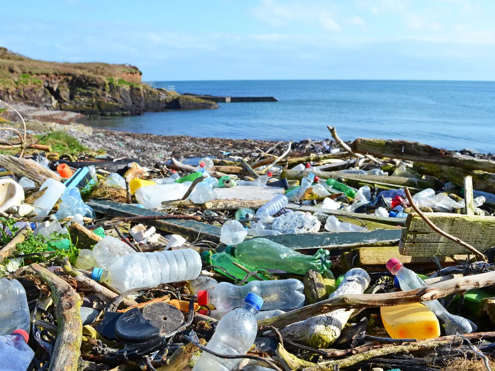
Even though that cerulean blue water might look gorgeous while you’re sipping a margarita, it’s not all it’s made out to be. Even though the ocean used to be much cleaner than it is nowadays, it’s still a terrifying revelation to just how dirty it is. There’s tons of garbage floating around underneath the ocean’s surface. The Great Pacific Garbage Patch lives between Hawaii and California and is 600,000 square miles. This is more than twice the size of Texas. About 1.15 and 2.41 million tonnes of plastic enter the ocean from the rivers every year. It’s almost too much for us to keep up with (The Ocean Cleanup).
Now, We’ve Mapped More Of The Moon And Mars Than The Sea
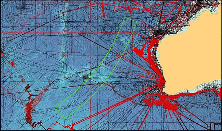
It turns out that scientists have mapped more of the moon and Mars than the ocean. Even though it’s vast, we only know about a small percentage. The ocean’s surface covers roughly 360 million square kilometers (139 million square miles), with an average depth of 12,080 feet. It turns out we’ve barely scratched the surface, thanks to nearly impossible conditions to continue our exploration of the ocean (Ocean Explorer).
There Are Dead Bodies In The Ocean
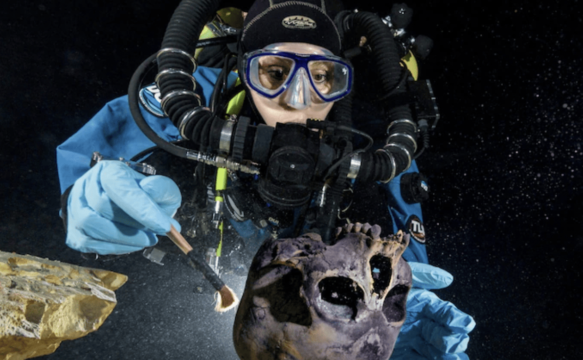
While charting the ocean’s temperatures and tide level might not seem terrifying enough, knowing dead bodies are floating around in the ocean might make it seem much more terrifying. Back then, people went into the ocean and never came out. No one really knows what happened to them. Without lifeguards or the proper search and rescue teams we have today, many people disappeared for good. Nowadays, you could technically swim past a dead body at any given moment. Divers in Mexico found the remains of a girl who must have wandered off and fallen into a deep hole, 12,000 years ago. Diver Alberto Nava said, “It was a small cranium lying upside down with a perfect set of teeth and dark eye sockets looking back at us.” Later, they discovered six bears, three cougars, and two sloths (Washington Post).
The Deep Sea Is Hot
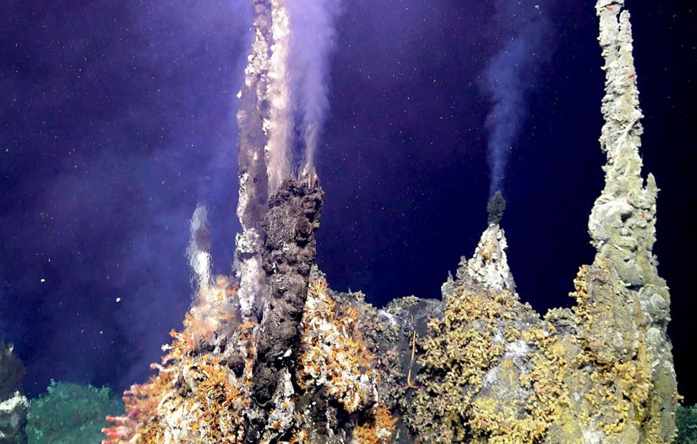
If you thought swimming in the frigid ocean meant it was cold down, you’re wrong. Deep sea vents, which are geysers on the ocean floor, can reach up to 700 degrees Fahrenheit. This occurs when two tectonic plates spread in the middle of the North Atlantic. The heated seawater is released as smoke. Even though this is terrifying, it is necessary for the ocean and surrounding ecosystem (The Daily).

It’s Full Of Viruses
Even though these viruses play a central role in the ecosystem, they can release toxins into the water, leading to a water crisis. And 10 million viruses can live in one millimeter of water. Professor of Ecology, Craig A. Carlson, said, “Microbial interactions, between oceanic viruses and bacteria, take place on the nanometer scale but are extremely important in governing the flow of energy and the cycling of nutrients like carbon, nitrogen, and phosphorus on the ecosystem scale of the world’s oceans.” Before scientists knew what was in the ocean and what they were studying, this mere fact might have scared them off (Futurity).
NASA Only Explores The Sea From Space
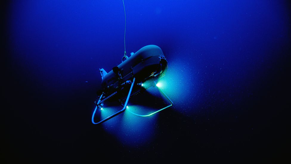
Contrary to popular belief, NASA explores the sea from outer space. People previously believed NASA explored the ocean, however, they chart the ocean from way up high. Thanks to a series of factors, like immense pressure, lack of sunlight, and deep waters, almost 80 percent of the ocean is unaccounted for, and NASA is not a part of that. But because it’s so eerie, there’s no saying what lurks at the ocean’s depth (Screen Rant).
It’s Just The Beginning Of Drastic Climate Chart Changes
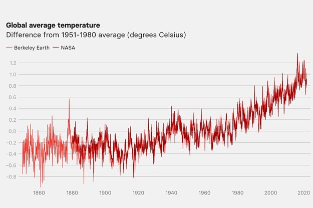
As much as most of us would probably like to turn our heads the other way, climate change is real. According to WHO biogeochemist Jens Terhaar, “While it is comforting to see that the models work, it is terrifying, of course, to see climate change happening in real life. We are in it and it is just the beginning.” Within the last century, we’ve seen a large spike in climate change. At this rate, it’s only going to get worse (Science Alert).
We Might Be Ahead Of The Climate Curve
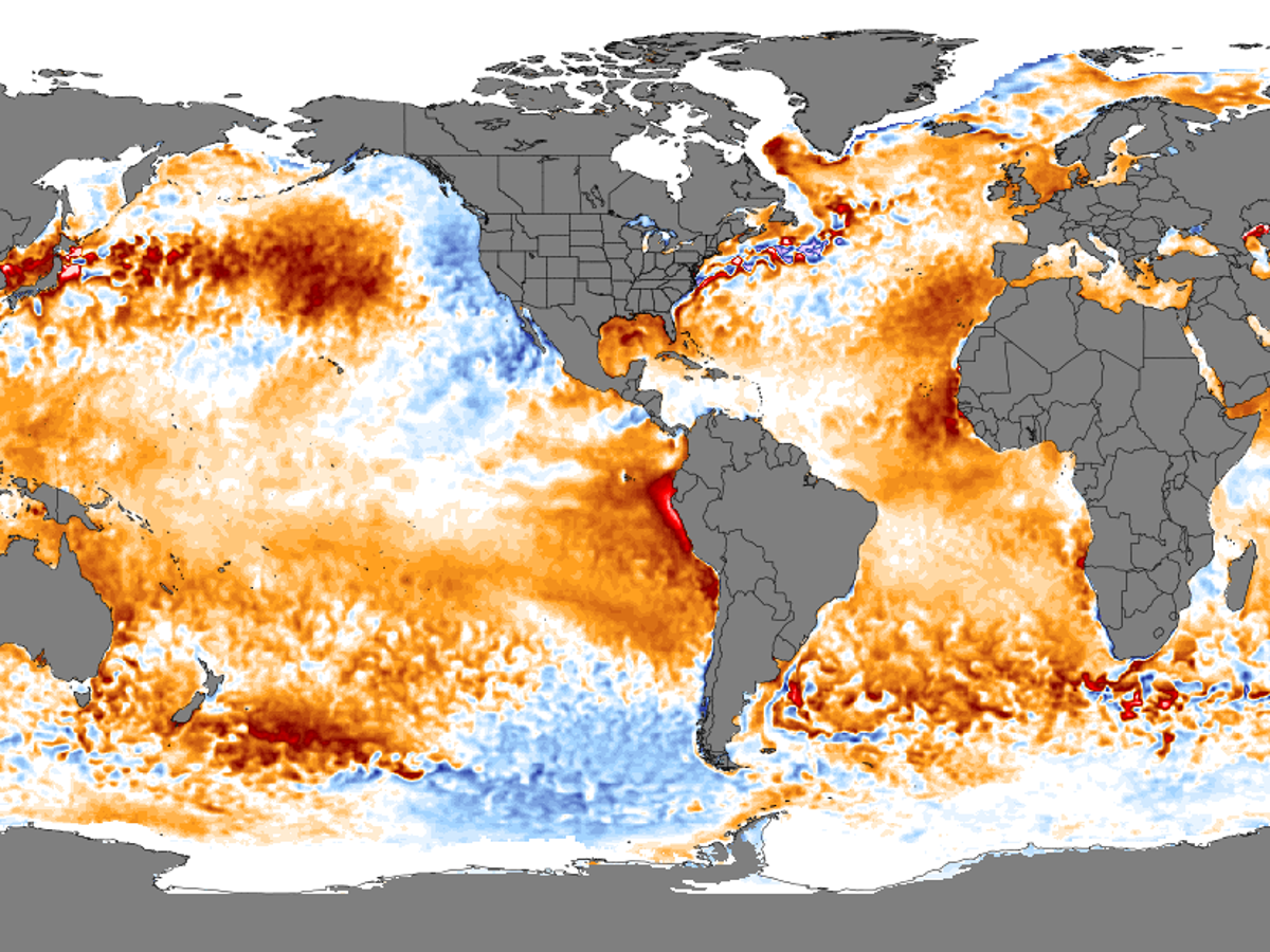
If this trend of rising ocean temperatures continues, we’re looking at a disastrous future for our oceans and earth. According to oceanographer Mike Meredith, “The cause for concern is that if it carries on, this will be well ahead of the climate curve [predicted] for the ocean. But we don’t know yet if that is going to happen.” It’s better to be safe than sorry, which is why researchers are keeping a close eye on charting the ocean (Science Alert).

It’s Getting Warmer Every Day
Scientist Svenja Ryan, who studies the ocean charts and climate specifically, said, “We’re seeing some animals compress their habitats, or some shift latitudinally if they’re capable. Or, like the corals in Florida, they just have no chance and die off.” This is a terrifying truth that we’re dealing with here on Earth. The closer they watch the oceans, the more they notice temperature fluctuations (NBC News).
It’s Not Too Late
Even though charting the ocean and watching drastic changes happen with the temperature, it’s not too late. Climate Katharine Hayhoe said, “It’s true some impacts are already here. Others are unavoidable. But my research, and that of hundreds of other scientists, clearly shows that our choices matter. It is not too late to avoid the worst impacts.” This is good news, since it means we can induce change. That’s a positive outlook for our future and the future of the ocean (Science Alert).
